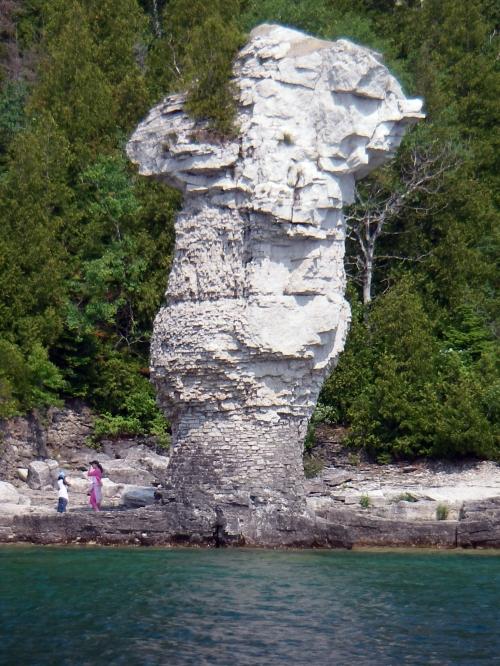
| It was a
short fast ride of 15 minutes before we neared Flower Pot Island.
We slowed down and went within about 100 yards off shore. This is
one of those spots that you just have to see, even if you’ve
been by here before. The scenery with the ‘Pots’ is fantastic,
and it is amazing that you are this close to shore and it is
almost 300 ft. deep.
Getting back up to cruising
speed, it was a fairly comfortable ride with the prevailing wind
and waves. There was a slight haze, and the temperature very warm
this morning. We have about 50 miles to Beaverstone Bay from here,
and the Lake was pretty much flat. For the first time, I actually
adjusted the helm seat forward and found that I could steer with
my knees fairly easy, which was the next best thing to auto pilot.
For long straight flat stretches like this, I can see where a true
auto pilot system would be nice.
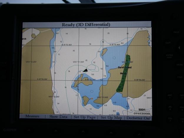
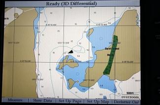
At 11:25 we neared the Club
Island waypoint and decided to cut the corner closer to Lonely
Island, and the depth sounder still showed 340 ft. The chart
plotter showed us averaging 29mph / 20.5 knots for this leg. A
half hour later the waves started building some and the sky was
turning gray to the west. We passed the Gull Island light at 12:15
and Gina put the isinglass up. |
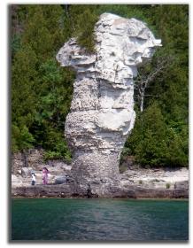
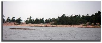
Flowerpot Island
|
|
|
|
|
| Fifteen
minutes later we were at the outskirts of ‘The Chickens’
shoals, and the waves and wind were kicking up a little more. Here
is where you need to pick up the D86 buoy, and then head due north
for a mile to D88, and then turn 45 degrees northeast to enter
Beaverstone Bay. My waypoints were marked just off the (short and
skinny) buoys, so with the waves it gets a little tricky to find
them. Obviously you don’t want to literally hit them, so
Gina and I both kept our eyes peeled as well as used the radar to
pick them up.
We were still at cruising speed,
but we slowed down after passing the D90 and D92 buoys between
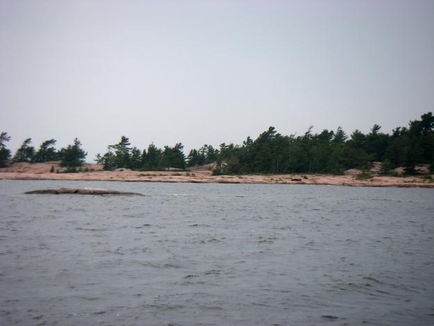
Hincks and Toad Islands, and entered Beaverstone Bay. When you
come through this way you immediately see all rock and more rock
and it really feels like a ‘different world’ as compared to
Lower Michigan cruising. There were a couple of kayakers paddling
through the water as we went by.
|
|
|
|
Beaverstone
Bay
Protected
Anchorage
|
Once
past Toad Island, we deviated northwest off the buoyed route
and west of Barto and Baltzy Islands. We took it slow and
made our way up about a mile and a half to a spot we had
marked behind Burnt Island. There is plenty of water here
and it is a common spot for anchoring.
At 12:50 we set anchor
about 100 yards off of a small islet next to Burnt Island,
dodging a deadhead sticking out of the 12-14ft. deep water.
A very nice protected anchorage for the night. The
tripometer read 286 miles so far for the three days, with
today’s leg at 56 miles from Tobermory.
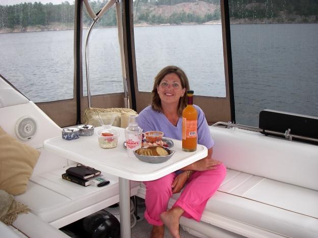
After we settled in, Gina
made us lunch, egg salad for me; salad and cheese for her.
It was still early, so afterwards we decided to do some
exploring. I released the dinghy from the davits we
installed just recently, and mounted the outboard motor. In
2004 we only had an inflatable with oars, so this was going
to be much better than rowing. We only have a small 3.3hp
motor, but the nice thing is that it fits snugly out of the
way in the transom locker.
|
|
|
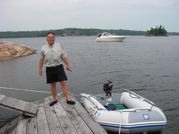
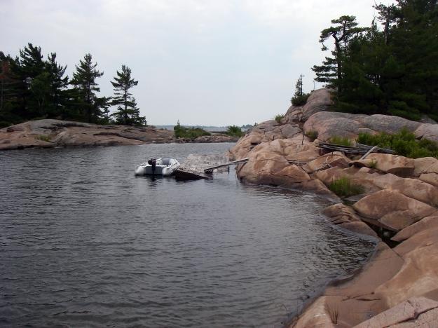
| At
1:30 we motored over to the small islet and found a small
temporary dock that was tied precariously to the rocks, a
perfect spot to pull up to. Wow, this was neat. We walked
and toured the small island, made up mostly of rock, but
with a lot of trees. We took lots of pictures and videos. It
was neat seeing the boat anchored from shore. Some of the
walk included traversing some rough rock. We went to the
south side and could see Beaverstone Bay and out into Lake
Huron. The only sign of civilization was an old decayed
outhouse pit. Made for an interesting picture. |
|
|
| I
had brought the handheld GPS unit with me so we could record
our dinghy / walking tour and see it on the charting
software. After about 45 minutes we got back in the dingy
and proceeded northeast to the tip of Burnt Island. But as
we rounded it, the wind and waves started to get us a little
wet, so we headed back.
I set up a folding chair on
the swim platform and relaxed with a Corona. It doesn’t
get much better than this! It was still warm out and I could
occasionally hear some boat in the distance. About 4:00 it
started to rain off and on and we read for a while, listened
to the news on the satellite radio, and ended up taking an
hour nap. |
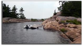
Dinghy Docked
|
|
|
|
|