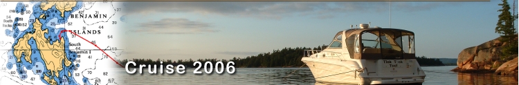
More Images

Chart & Tracks

Video


Day 2 
Friday June 30th    Grand Bend Harbor to Tobermory


After a nice morning walk to the Beach in Grand Bend, we cast off, pressing onward and northward. After a fuel stop at one of our favorite ports; Kincardine, we keep cruising while Lake Huron is nice and make it to Tobermory.

Miles Today:
142

Destination:
Tobermory

Stops:
Kincardine


Little Tub Harbor at Tobermory
Docked at Tobermory

We woke up at 8:30 on day two. Gina took a shower while I made coffee. This was the first year that we really started using the shower on the boat. It’s somewhat small in the head, but we are now taking advantage of it. 

It doesn’t take long for the hot water heater to warm up, and it's often easier than loading up your supplies  and clean clothes before trekking off to the local marina bathrooms.

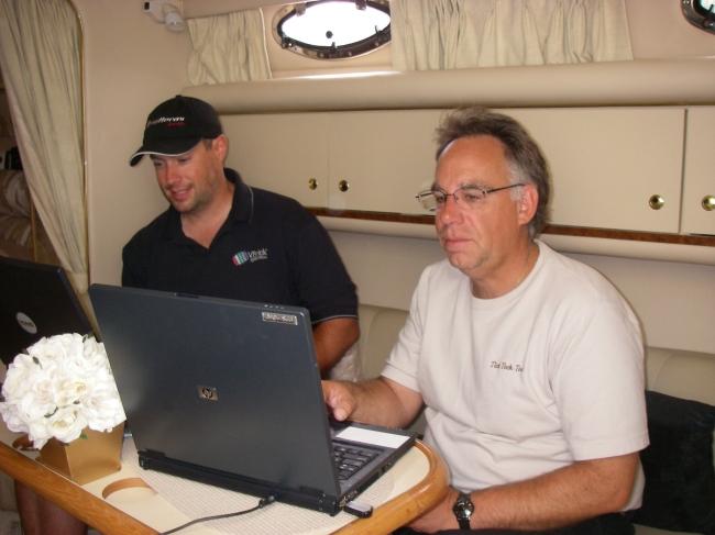
We cleaned the boat and then Seth from Sport 'n Life came over for coffee and a visit. He had a problem with accessing the chart software he just got so I was able to help. I had plotted a route through the Clapperton Channel with my Maptech software on my laptop and was able to download it onto his hand held Garmin GPS unit. 

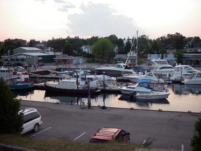
I quite often plot on the PC and upload to our chart plotter.  I think we looked more like a couple of geeks than a couple of boaters with the laptops and GPS unit all wired up at the table, but I finally got the chance to help a fellow boater in need.

Gina and I took a stroll into the town of Grand Bend at 11:30, just a short walk down the dock wall and up some stairs through someone’s back yard to an alley and onto the main street.  We meandered a block through downtown and to the fabulous big beach. We walked up the stairs leading to a large long concrete observation tower for a nice view of the lake, which looked perfect for cruising.


Uploading Route for Seth


Leaving Grand Bend


On the way back through town we stopped a numerous T-Shirt and gift shops, but only purchased a couple of beer cozies. We did manage to see an Orange Julius stand and split a cold drink before returning to the boat.

After disconnecting the electric and water, and saying goodbye to Marc, Seth, and Ingram from Sport 'n Life, we untied and shoved off at 12:45. We passed the gas dock and did what the dock master told us, throwing the bathhouse key on the dock as we went by. There were quite a few people on the pier as we cleared the channel.

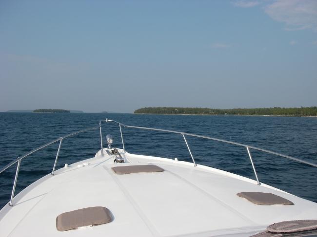
The fuel gauge was at ¾ and the tripometer at 88 miles as we headed north on Lake Huron. It was quite clear and sunny with perhaps one-foot rollers. A very comfortable cruise as I called up the NOAA forecast on my Blackberry. We were traveling about 4 ½ miles off shore at 1:30 as we passed Bayfield , and Goderich about a half hour later. Gina went below for a nap, and I noticed the waves starting to build a little to 1-2 footers.
About 2:45 Gina made some salami cheese and onion sandwiches for lunch, so we throttled back and just drifted for a while. We then got on the cell phone and called both Kincardine and Port Elgin to check fuel prices. Kincardine was at $1.10 per liter, and Port Elgin at $1.13. So after a short lunch break we headed to Kincardine.

We hit the Point Clark waypoint at 2:55 and the lake turned somewhat calmer, so we bumped up the speed to a little over 30 mph and headed northwest into Kincardine. We pulled up to the fuel dock at 3:20p.m. and it looks like we’re about the only ones here. The nice thing about Canada is that the dockhands fuel the boat.

We walked around the marina for about 20 minutes and I bought a Kincardine Yacht Club t-shirt. We had stayed overnight here on our 2004 trip and always enjoyed the cool lighthouse next to the marina, where a Pied Piper plays at sundown.

We took on a total of 128.36 gallons and paid $538.77 cash in Canadian funds. We’ve come 151 miles so far and Gina calculated we’ve averaged  .844 mpg for the trip.

Kincardine Lighthouse
Kincardine Fuel Stop

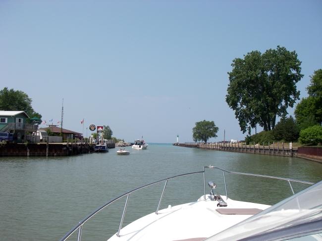
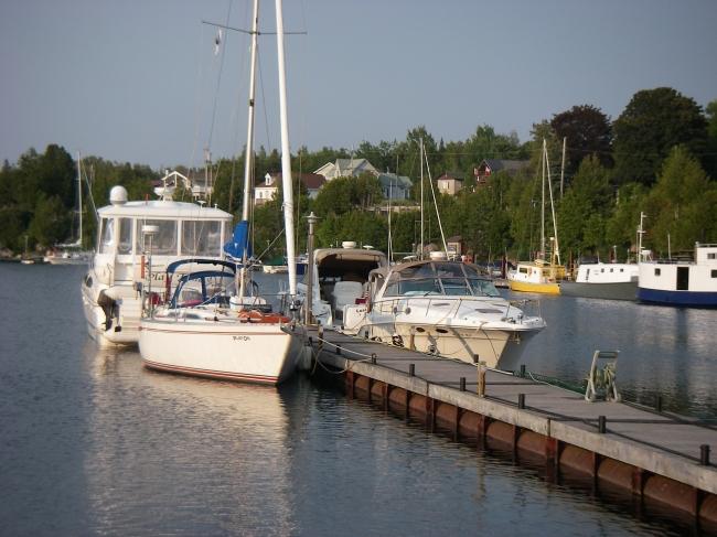
At 3:55 we cast off from the gas dock and made our way out the Kincardine channel back out to Lake Huron. Turning north, I reset the Chart plotter to get back on course. The sun was out in force and the water was fairly calm, as we throttled back up to about 29 mph cruising speed. I took advantage of the smooth ride to enjoy a cigar at the helm.


Cape Hurd Nearing Tobermory

We passed even with Port Elgin at 4:45. We were running about 14 miles off shore from the Bruce Peninsula at this point, before the land curves back west at the top of the Peninsula at Cape Hurd. We were originally going to meet up here with a group from MacRay Yacht Club, including Mytigood and Lime Cutter. But the water was so nice we decided to keep going north another 60 miles to Tobermory. We still had a tentative plan of meeting up with them again in Mill Lake in a few days, so hopefully we would hook up then.

Continuing north, at 6:15 we rounded Cape Hurd through the buoys in what is called the Southeast Bank, as we entered the Cape Hurd Channel. This is a narrow pass between the tip of the Bruce Peninsula on the south, and Devil and Russell Islands to the north.
You have to pay attention to the (short) buoys to navigate through here. For the most part there is plenty of water, with a few rocks and shoals, including the China Reef. Many boaters take an outside route to the north, known as Devils Island Channel, to avoid this tricky area, especially in inclement weather conditions. This was our second time through here, both in good weather. I felt very comfortable with the route programmed into the Chart plotter, and you pretty much have to trust it, as it can be difficult to see the buoys. A few minutes later, still at cruising speed, we turned dead east into Tobermory Harbor, before making the final cut due south, directly into Little Tub Harbor. 


Tobermory Little Tub Harbour

At 6:45 I hailed the harbormaster and was directed to Dock #2, which is right up front. Not many boats here, considering it's Friday night.
As we pulled up to the floating dock, we ended up right behind one of our MacRay Yacht Club friends, Richard and Carol from Last Chance. They were on a trip with their nephew, heading east from here into Georgian Bay, with an ambitious itinerary including a stop at Parry Sound.

After securing the boat we hooked up both water and electric. They have new electric and water service on this dock that wasn’t here during our brief layover in 2004. At 7:45 Gina prepared us some shrimp salad for dinner, and we sat on the back deck to eat, relax, and take in the surroundings.

Around 10:00p.m. Gina was working on her postcards and a Frangelico while I made notes in the logbook.


Dock #2


Shrimp Salad Dinner


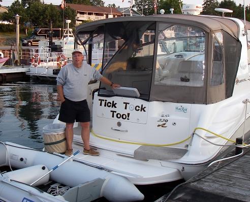
I later downloaded the days’ track to the laptop from the handheld GPS. This was a daily chore. I used my Magellan hand held GPS both as a backup, and to record the days trip. It easily downloaded the tracks into the Maptech software on the laptop so we could see exactly where we traveled for the day. This also saved it for reference later on.

At 11:00 I poured a drink, lit up a fine cigar, and strolled down the harbor to find a payphone. I talked to my Dad for a while and then left a message for Jim from Lime Cutter to where we were.

 This was a great Day 2!


Day 2 June 30th  2006 On to Day 3
More Images of Day 2 Charts & Tracks of Day 2 Video from Day 2