 |
|||
|
|||
|
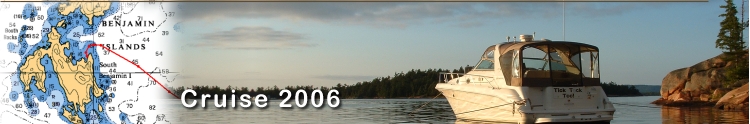
Miles Today: Destination: Stops:
|
|
||
|
|||
|
|||
|
Miles Today: Destination: Stops:
|
|
||
| I
first attempted to start the port engine (which is wired to the house
batteries) and it came right to life. I quickly shut it down, and then fired
up the generator, which started fine on the first try. Made a pot of coffee and
listened to the forecast on the VHF. There was a small craft wind
advisory in effect; winds were west at 20 knots diminishing to 15 near
noon, and 10 knots in the evening. A chance of showers or
thundershowers. Currently the wind is out of the west, with a mixture of
clouds and blue sky. The boat had swung with the change in winds, so we were
now getting a different view. (Can't do that with your house or
cottage).
I tried reaching Bill from Instead Of on the radio at 9:00 to no avail. I really didn’t expect to get in contact them this early, let alone today. They were going to try to leave from their homeport in Leamington Ontario a few days ago on Saturday sometime, and then try to rendezvous with us in Mill Lake, which would at the earliest be late today or tomorrow. Around 10:00 I saw finally saw ‘civilization’ as a small speedboat went by to the west and a fishing boat cruised by the southeast corner of Burnt Island. Gina had gotten up now, and we relaxed on the back deck. A few minutes later I was listening to the VHF radio channel 16 and the Coast Guard was responding to a request for medical evacuation from a boat on the north side of Franklin Island. They were mentioning a burn victim. I listened to these communications for about 40 minutes. The call went out requesting the boaters on the island to set flares, and find a clearing of 400-500 ft. so a helicopter could land. I could only hear the Coast Guard side of the transmissions, and they were requesting other mariners help. I didn’t even know where Franklin Island was, but deduced it was probably some ways away.
|
|||
| Our fuel
situation was a little uncomfortable. (Okay, a lot
uncomfortable). We were showing less than 1/8 on both tanks. We had
filled up in Kincardine just like in 2004, where we made it to Mill Lake
and Killarney with no problem. But this year, perhaps with rougher
water, we evidently burned more. If we were going to run out of gas, we
figured to get it out of the way now. So, we decided to bypass Mill Lake
and run all the way to Killarney (20 miles) to get fuel. We’d then
return back to Mill Lake, feeling a lot less stressful.
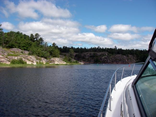
We prepared to leave, stowing the dinghy and motor as well as cleaning the glass. At 11:35 we pulled anchor and wound our way from behind Burnt Island back to the marked Beaverstone route. This led us up to the turn to head into Collins Inlet and west to Killarney. It was a strong west wind and we were heading right into it now. Seemed like a lot of black flies were out now. Collins Inlet is really something. It is narrow in many spots with rock walls on both sides. There weren’t any other boats around so I decided to try to run on plane for a ways. It was very exhilarating going so fast in such close quarters. After 3 ½ miles we entered the top of Mill Lake, and then picked up Collins Inlet going west again. |
|
||
|
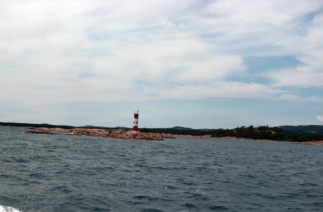
Another 8 miles and we passed
Keyhole Island and turned south west past more rocky shoreline
before going by Flat Rock Light. Here is where it opens back up into Lake
Huron for the final 3 ½ miles to Killarney, and you really
start seeing the quartz ‘mountains’ that this area is famous for. |
|||
|
|||
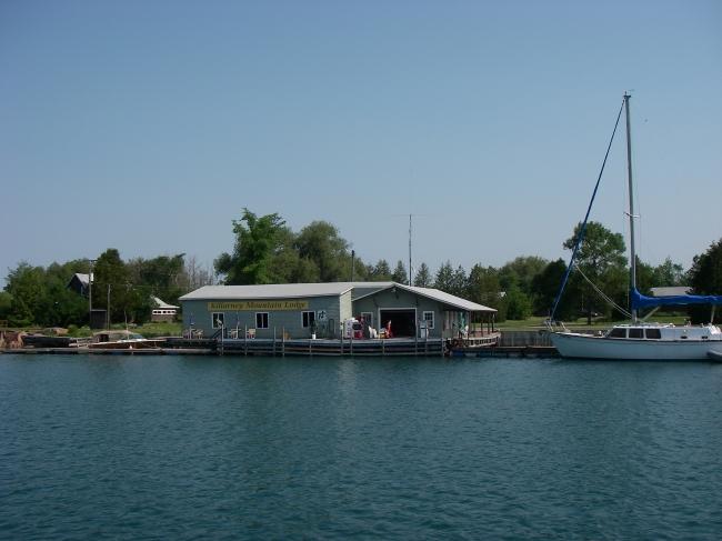
| The staff there
is really nice, and took all of our garbage away. They said it was no
problem tying up there while we strolled around a bit. So we
walked down the main street a block along the channel to get our
lunch. The old school bus is parked on the pier and serves up the
best fresh deep-fried fish and fries.
It’s a great place to eat and unwind while watching the boat traffic in the channel. An hour later we walked back to the boat at the Sportsman, where we bought a t-shirt and some ice (both block and bag). Of course the friendly staff carried the ice down the dock to the boat for us, and helped us shove off at 2:30. |
|||
|
|||
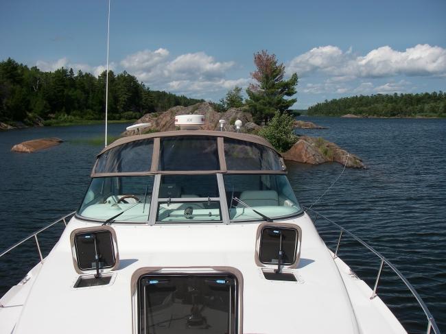
| Gina set the bow
anchor at 3:25pm and I quickly unhooked the dinghy and loaded up the
long stern anchor line and rowed the short distance to the islet. Once
there I tied the line around a large rock, and traversed the rocky
landscape to take a look around. We were now secure at the final
destination for the day, 37 total miles we've come today, including the
extra 32 mile round trip into Killarney for gas.
The weather was pretty nice now, so we put our swimsuits on at 4:00 and decided to take a dinghy ride around Mill Lake. There was a moderate wind, so we had to take it fairly slow to avoid getting too wet. I took the handheld GPS unit to record our track, and also had the handheld VHF in case we got a call from Instead Of. |
|
|
|
We motored down
to the south end of the narrow lake, and saw a small sailboat anchored
against the rocks. We had passed them a few hours earlier on our way
back from Killarney. It looked like they might be visiting someone in
the cottage that is located there. The water appeared to be shallow and very weedy in this area as we cut through between two small islets and headed back up the east side of the lake. We then made our way back west across the lake to some large rocks just north of our anchorage. We pulled the dinghy up on the rocks and took the cushions out to lay down for a while. Coming back to the boat a short while later on the west side of the rocks we noticed that our stern line had become untied. Actually the rock that it was tied around fell down, loosening the line. After securing it well this time, we docked the dinghy and took a nap for a while. |
|
At 8:00 Gina made a Turkey salad for me, and a Shrimp salad for herself. We then relaxed some more before watching a DVD on the back deck at 10:30. The stars were out on this slightly overcast night, as we turned in sometime after midnight with all the hatches open. |
|
| Day 4 July 2nd 2006 | On to Day 5 | ||
| More Images of Day 4 | Charts & Tracks from Day 4 | Video of Day 4 | |