 |
||
|
||
| Satellite Track | |
|
|
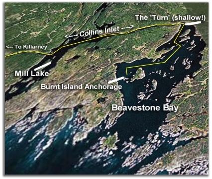
Courtesy of Google Earth The yellow line show us leaving our nice protected anchorage behind Burnt Island, heading through Beaverstone Bay, before turning the shallow corner into Collins Inlet. From Collins Inlet we headed west, where we bypassed Mill Lake, and continued through Collins Inlet to Killarney for fuel. We returned to Mill Lake to anchor in the afternoon. |
| Mill Lake Dinghy Tour | |
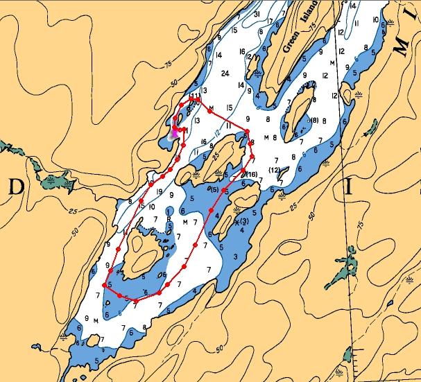 |
Fun and Sun in the Afternoon Here's the track of our dinghy tour we took in the afternoon. [x marks where boat is anchored] We headed along the western shore to the south end of the lake where we observed a sailboat tied up to the rocks. We then turned around and motored between the small islands. It was very weedy and a little shallow. We then cut back across west and 'beached' the dinghy on one of the small islets to sun and relax a bit, before going behind the islets back to the boat. The whole tour was just over two miles round trip.
|
| Day 4 July 2nd | On to Day 5 | ||
| More Images | Video | Log | |