 |
||
|
||
|
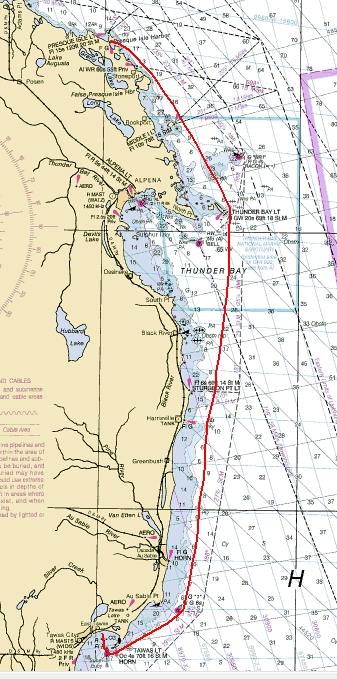
Heading South Our route on Day 16 heads us closer to home. |
|
|
We leave Presque Isle and start out heading southeast past Stoneport
and False Presque Isle and then close to the G13 green buoy at Middle
Island.
We then split the waters between Stonycroft Point and the large 'WR1' racon light that marks the shipping lanes. This inside route turns us almost due south at Thunder Bay Island. From there it is a 50 mile run to the buoy off of Au Sable Point. Following the Michigan shoreline, we pass the ports of Harrisville and Oscoda. Another 10 miles to the 'R2' buoy, and then turning straight north into Tawas Bay and the docks.
|
|
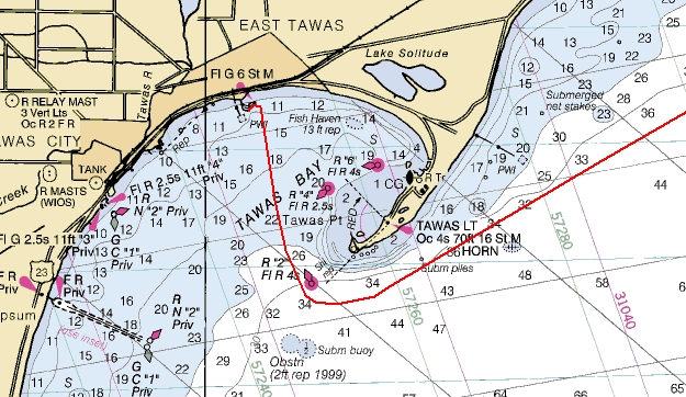
Into Tawas Bay After rounding the point on the southeast side of Tawas Bay, it is a straight shot into the State Docks. |
|
|
|
|
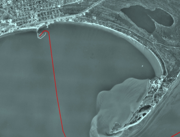
View from the Sky Here is a satellite view of Tawas Bay and our route into the State Docks to fuel up and the our slip for the night. Note the shoaling and shallow water around the point. |
|
|
|
|
| Day 16 July 14th 2006 | On to Day 17 | ||
|
|
|||