|
|
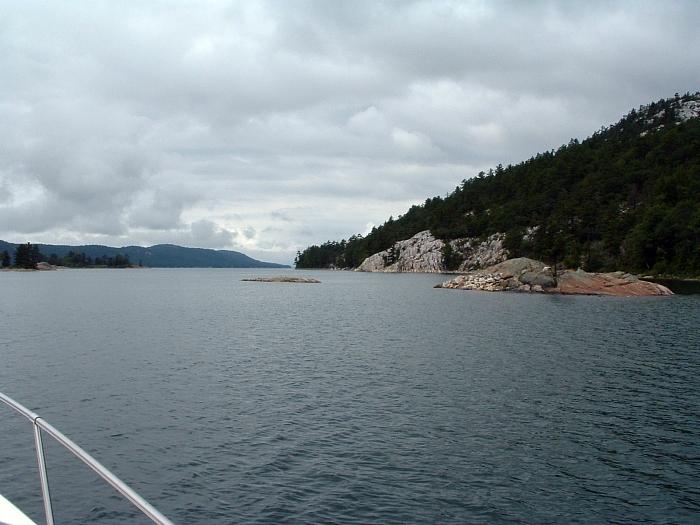
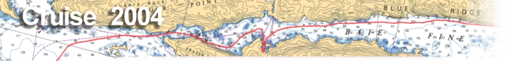
| The sixth day takes us from the tranquility of The Pool, back out Baie Fine to head westward. Through Frazer Bay and north of Heywood Island, we round Strawberry Island and end up at Little Current. |
|
|||
|
|
|
||
|
Destination: Via: |
|
You just knew that
the excellent weather we've had the five previous days was going to end.
This morning we woke up to a light rain, a moderate wind, a very
cloudy sky. For breakfast Gina made up some toast and blueberry muffins in the toaster oven. I grabbed an orange juice out of the cooler and brewed a pot of coffee while we discussed the day's plans. Today we head west to Little Current and (hopefully) beyond. We weren't sure if the weather was going to be conducive to traveling for any great distance today. |
||
| After breakfast we untied the stern anchor line and lashed the dinghy to the swim platform. It was now 11:00 and I fired up the engines so we could head out. Both us and the Instead Of had our bow anchors out as customary, and in trying to bring ours up they were getting tangled. So Gina and Bill used boat hooks to sort them out. I hated to leave this nice place, but with the weather I sure was happy that we made the trek here yesterday and not today. | ||||
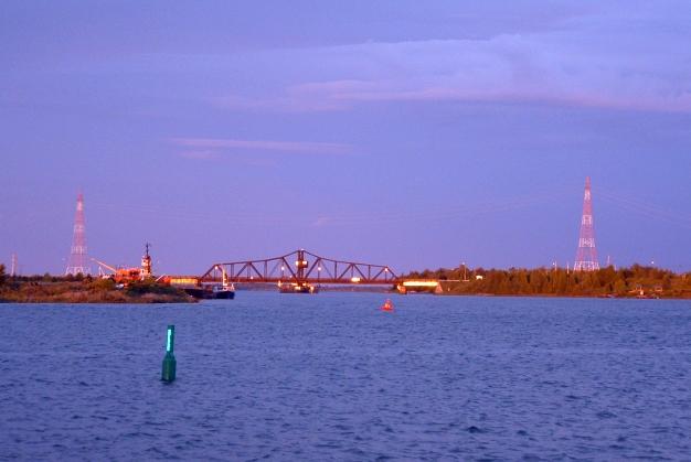
We rounded the island and started to close the distance between us and the cruise ship. I had plotted us to take the suggested route straight west to the J24 buoy, which then follows the angled shore line into Little Current, but you can take a 'short cut' straight across. |
||||
|
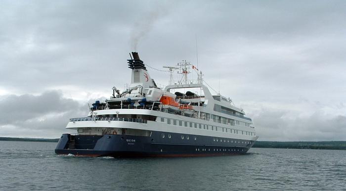
We were now coming up on the cruise ship fast.
I decided we needed to pass it before we got to much farther, ideally
before the route narrowed as we got close to Little Current. We got fairly
close as we passed and could read the name on the stern, "Orion"
from Nassau.
We now picked up the J24 buoy and headed north northwest closing in the shore of Manitoulin Island. We turn west into the channel at Goat Island. . A short distance down the channel, which is marked rather well, we come up on the swing bridge. The bridge only opens on the hour. At first we idled close by with many other boats, but it wasn't scheduled to open again for another half hour or so. I had checked a lot of navigation aids on charts, but had never checked for what the clearance was under the bridge. So, we motored slowly up and could tell once we got close that it was not a problem to go underneath. Instead Of was close behind us and put their antenna down and went under also. |
|
|||
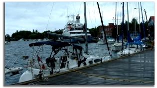
| The wind was really picking up now. Up ahead a bout a half- mile are the town docks, basically one large seawall that can accommodate a lot of boats. We started looking for a spot to tie up to, and the closer we got we could see that boats were tied end to end along the wall with no spots. I turned on the radio and heard the announcement that the cruise ship would be tying up at the east end of the wall, therefore taking up valuable dockage space. Idling westward, we saw what looked like one space at the west end open, so I maneuvered nearby, and Hank and Gina set the fenders and we pulled in. It was now 1:00 p.m. | |
|
|
Talking to Bill on the radio, he had wanted to
take the space and have us raft off of him, but Gina didn't care for that.
And Gina is in charge of anchoring, rafting, and docking. She knows and
prepares all the lines, the fenders, and the anchor. So we did it her way.
After we got situated, there was still 'some' open space behind us and a 30 foot sailboat that was tied up. Bill was determined to pull in there. Gina walked it off and it looked like maybe 35-40 feet space. He backed the Instead Of in the small opening and nudged his stern to our stern. There was not enough room for his 40 footer to fit here, so he angled the bow out a little, and put a large round fender between his bow and the sailboats bow. Meanwhile, his swim platform was riding over our swim platform, so I tried to make some adjustments, including putting a fender between them. It was not an ideal situation. |
|
I took a walk down the docks and over to the stone gazebo just off main street to seek shelter from the rain. It was coming down steady for a while now. I enjoyed a cigar and contemplated our next move. Originally I had wanted Little Current to just be a 'stop' on the way to the Benjamin Island area, but with the rain and the wind coming up, and not expected to clear today, it was clear that this is as far west as we would get. It would be time to head back east tomorrow. The rain let up at 2:00, but the wind did not. Monitoring the radio traffic we listened to many boats asking about dockage. The cruise ship was scheduled to leave at 7:30 tonight, and that would free up quite a bit of dock space. There are a couple of marinas, Spider Bay and Boyles, that only had limited space as well. Some boats decided to head for Killarney, Gore Bay, and elsewhere, while a few elected to idle or anchor in the channel hoping that a spot opened up. |
|
| Gina and I decided
to find the Library and send out a few e-mails. From the boat, the
downtown area is just a block away. Someone told us that the Library is
"just up the street and down the block". We walked several
blocks (uphill) and I finally flagged down a driver who told us "just
one more block". The town Library is very nice and had a bank of
computers set up. We were the only ones there. I checked the news on-line
and Gina checked her e-mail. After a short while, we headed back to the
boat.
Arriving back at the docks, Bill was attempting to move our boat up a foot or two to make more room for his. Now the wind was getting really strong, and the boats were starting to rock quite a bit at the docks. The people from the sailboat behind the Instead Of came up and said that they weren't too comfortable with the way Bill's boat was crunched in against theirs. The short spot along the seawall was not going to work. Within a couple of minutes, Bill hurriedly started the engines, we untied Instead Of, and shoved them out into the harbor. |
|
|
|
For lunch we had left-overs, including chicken
and the fresh fish from the guide at The Pool. Farther down the dock were
the restrooms and showers for the boaters. It had been several days since
a nice hot shower and it felt pretty good. We found the Instead Of at
Wally's Dock Service at the east end of the Town Docks. He filled up with
gas and bought a few items from them. They told him he could remain tied
up there as long as no one else wanted to come in for fuel.
Finally, around 7:30, the cruise ship departed. Bill played it just right and only had to go a few hundred feet to get a prime spot along the docks for the night. |
| Later on for dinner we had salad, while Bill and Mary walked into town for a buffet. We caught up with them a little later, and we strolled the downtown area, looking in storefronts, and checking things out. Not much activity here on a Wednesday night. Due to the weather, there were a lot of boats tied up at the docks for the night. I downloaded the days' GPS tracks onto the laptop. We've come a total of 365 miles so far, and tomorrow we would start the journey back. | |