|
Miles:
143
Destination:
Mill Lake
Via:
Tobermory, Flowerpot Island, Beaverstone Bay |
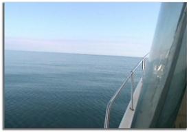
Lake Huron: Smooth Water!
|
We cleared the
piers at Kincardine about 8:30 a.m. to head north. Lake Huron was unbelievably
flat. No waves, and hardly any wind made for great cruising. We were able
to travel at a good clip and it was a very comfortable ride.
Originally Bill was thinking to follow the
coast up the Bruce Peninsula, but we decided to bear a straight line
course to the Cape Hurd Channel #TE buoy, 60 some miles, and then
turn the corner to head into Tobermory. |
|
|
|
| There
is an alternative route just a little north called Devil Island Channel
which is said to have less shoals, more room, and deeper water. But the
Cape Hurd Channel was no problem; we passed by 5 buoys in three miles that
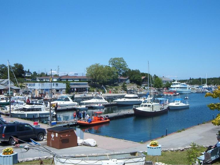
I had marked, before heading into Little Tub Harbor around noon. The Instead Of took
the lead and we just followed them into the Harbor.
We ended up finding space at the docks at
the end of the Harbor. It did get a little tricky pulling in, as we
had the large Blue Heron Tour boat right on our tail, and a bunch of
people in kayaks just a few feet in front of us heading out from the ramp.
This was "prime parking" right in the heart of town next to the
boat launch. We tied up and Gina made us some shrimp salad for lunch.
Walking through town, Gina bought a walking stick for her daughter
Adrienne. |

Prime Parking at Tobermory
|
|
We stopped by the Glass Bottom Boat tour booth
and thought about taking one out to Flowerpot Island and observing some of
the shipwrecks that are scattered in the area. We picked up some
literature and decided we should just visit the island on our way to
Beaverstone. You can't really get your own boat right over the wrecks, but
getting close to the Island looked fairly straight forward. With the
weather and lake so nice, it was easy to decide to keep going north this
afternoon instead of laying over for the night. |
|
|
|
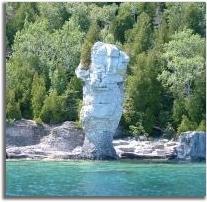
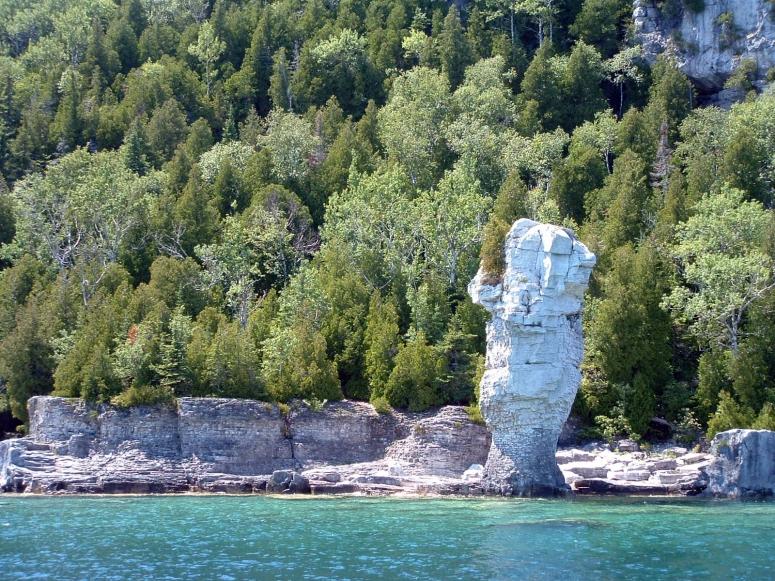
Flowerpot Island
|
At 2:00
we left Tobermory for the short three mile trip to Flowerpot Island. As we
got closer, you could see the "pots" on the northeast end of the
island. "Is your depth sounder reading what mine is?", Bill
asked over the radio. Wow, it was actually 295 ft. deep just off shore.
This was a fantastic sight, and we slowed down to drift and take in the
view. After relaxing and taking a lot of pictures, we idled around the
east end of the island to get a close-up view of the light station before
getting back on course to Beaverstone Bay.
The next mark we hit on the 55 mile trek to
Beaverstone is 15 miles northeast, between Club Island and Lonely Island.
During planning of the cruise we had debated heading towards Killarney or
going into Beaverstone Bay.
|
|
|
Wanting
to see Collins Inlet, it made much more sense to hit Beaverstone first,
rather than going to Killarney and head back west. From our Club Island
waypoint, we turned to a course of 40 degrees and after another 20 miles
passed Gull Island, a small patch of land with a red and white tower. Four
miles farther we spotted the D86 buoy marking the fringe of islets known
as The Chickens, then turned straight north for the D88 buoy, before
turning again for the shot right into Beaverstone Bay.
It was a great feeling (and relief) traveling
such a distance and finding these buoys. I had "practiced it" all
winter on the charts and computer. The one thing about the Canadian buoys
('spars') is that they are quite a bit smaller and skinnier than the ones we
are accustomed to in American waters. The leg from Flowerpot to Beaverstone
was not quite as flat as when we left Kincardine earlier in the day, but is
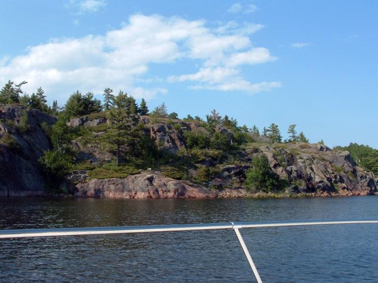
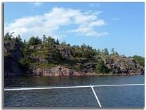
was still relatively calm. We entered Beaverstone Bay just before 5:00 p.m.
and the sight was awesome. Lots of pink granite rock, and the white quartz
make up of the LaCloche mountain range in the distance gave the appearance
of snow capped mountains.
|
Coming Into Beaverstone
Bay
|
| Navigating
through the Bay between the islands and rocks can be a little
intimidating, but there are well placed buoys as well as day markers
placed on some of the rocks that help. By plotting a few waypoints and
paying attention the the charts, it is fairly easy and safe. The Canadian
charts also have the suggested 'small craft route' already shown. We took
it slow just admiring the sights. I tried to keep one eye on the GPS and
charts, and one eye to take it all in, because it truly is spectacular.
Beaverstone Bay is approximately 5 miles long, and there are numerous
spots to anchor. You'd need to do some research and be extra cautious if
you plan on going off the beaten path throughout here. |
|
|
Collins Inlet
|
At the north end of
the bay as you approach the D96 buoy it narrows quite a bit near the
Pisa Rock marker. This then leads you to four sets of buoys before
you take a 90 degree turn west into Collins Inlet. There also is a white
caution buoy here, warning of low water. The water levels this summer were
high enough so no problem. It was all so serene, with only one small
speedboat the only sign of civilization we encountered.
Entering Collins Inlet you find trees growing
right out of the high rock walls, and even a small waterfall. There are no
buoys located here, so we just cruised down the middle. Sometimes we were
side by side with the Instead Of, close enough to carry on conversations.
Mary sat on the swim platform of their boat, dangling her feet in the warm
calm water, which showed 74.6 degrees on our temperature gauge.
|
|
|
| Gina took the wheel
for a bit (dancing at the helm to the stereo) so I could walk up front to
take some pictures. About three miles
west down Collins Inlet we take a gentle turn southeast into Mill Lake,
just past the day marker on Turtle Rock. As we head into the lake we see
several boats anchored on the eastern shore. I had talked to several
boaters from our marina that described a nice spot to anchor, and tried to
pick it out on the charts. Passing Green Island on the left and then
hugging the western shore I watched the charts as well at the depth
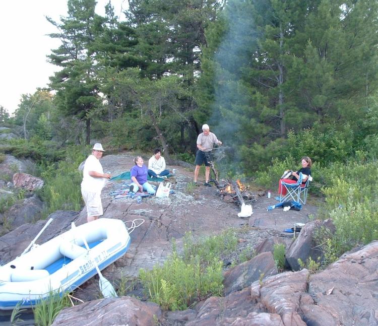
sounder. I thought I found 'the' spot I wanted but as I got closer saw we
needed to go a little farther, finally settling in a little cove, with a
small rock islet just outside of it. We 'snuck' right in and decided this
was a fantastic anchorage. The Instead Of pulled in behind us and we
maneuvered to set the bow anchors and raft off. It was 7:00 p.m. and the
sun was shinning bright and it was still quite warm. |
|
|